


tours au dessus vvf les estables

Robertplessier
User
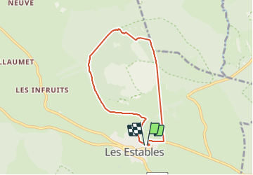

Length
6.5 km

Max alt
1587 m

Uphill gradient
236 m
Km-Effort
9.6 km

Min alt
1359 m

Downhill gradient
236 m
Boucle
Yes
Creation date :
2021-08-04 14:28:25.021
Updated on :
2021-08-04 15:17:56.308
49m
Difficulty : Very easy

FREE GPS app for hiking
 SityTrail
IGN / Geographical institutes
SityTrail Plus
The world is yours!
About
Trail Running of 6.5 km to be discovered at Auvergne-Rhône-Alpes, Haute-Loire, Les Estables. This trail is proposed by Robertplessier.
Positioning
Country:
France
Region :
Auvergne-Rhône-Alpes
Department/Province :
Haute-Loire
Municipality :
Les Estables
Location:
Unknown
Start:(Dec)
Start:(UTM)
591504 ; 4973004 (31T) N.
Comments